
Índice de Contenidos
Ruta del Cares
HOW TO DO THE CARES ROUTE?
1. Description
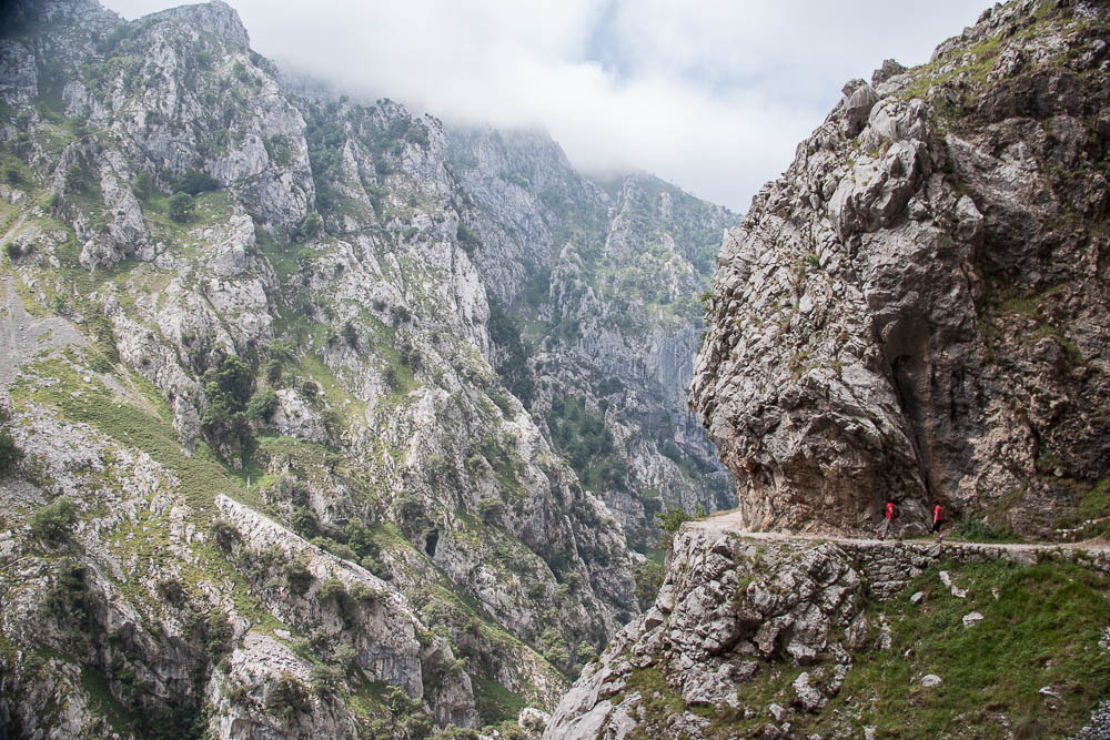
The Cares Route runs through the “Divine Gorge” of the Cares River in the Picos de Europa National Park. The river originates at the Fuentes de Freñana, between the mountain passes of Pandetrave and Panderrueda.
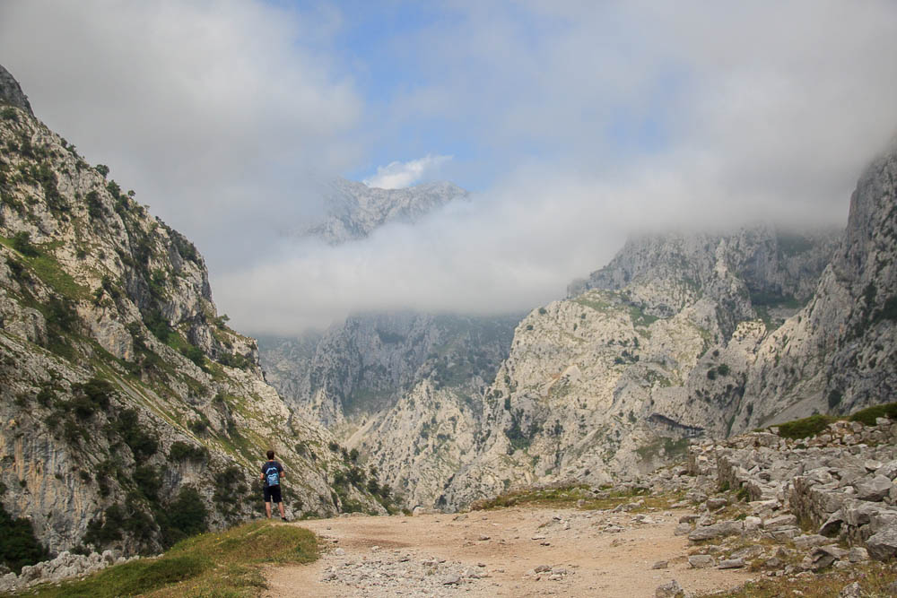
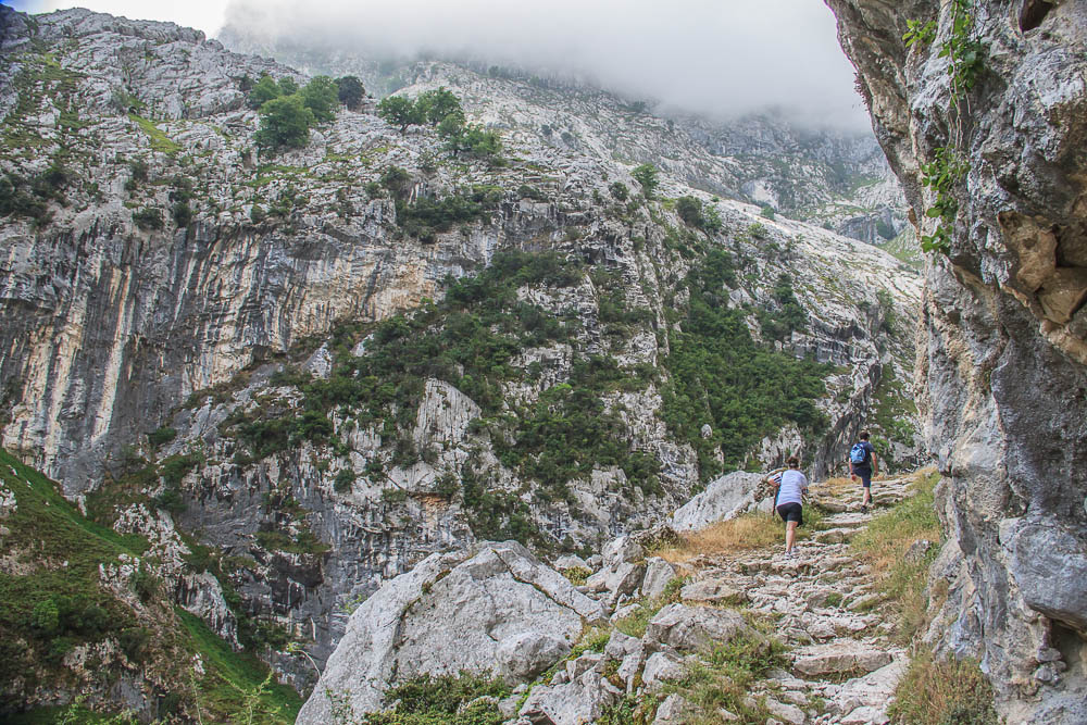
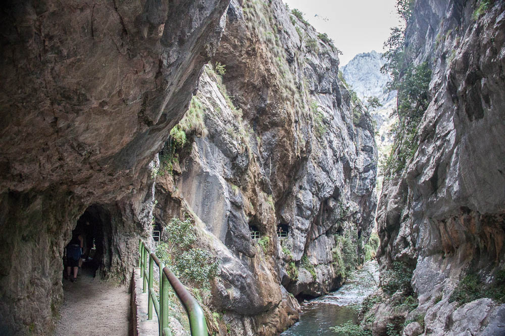
It is a linear, mid-altitude trail, 12 km long, featuring a sheer rock wall on one side and a steep drop (precipice) on the other—without railings. The path is roughly 2 meters wide. It connects the villages of Caín (León) and Poncebos (Asturias). The hike takes about 3–4 hours one way, or approximately 8 hours for a round trip.
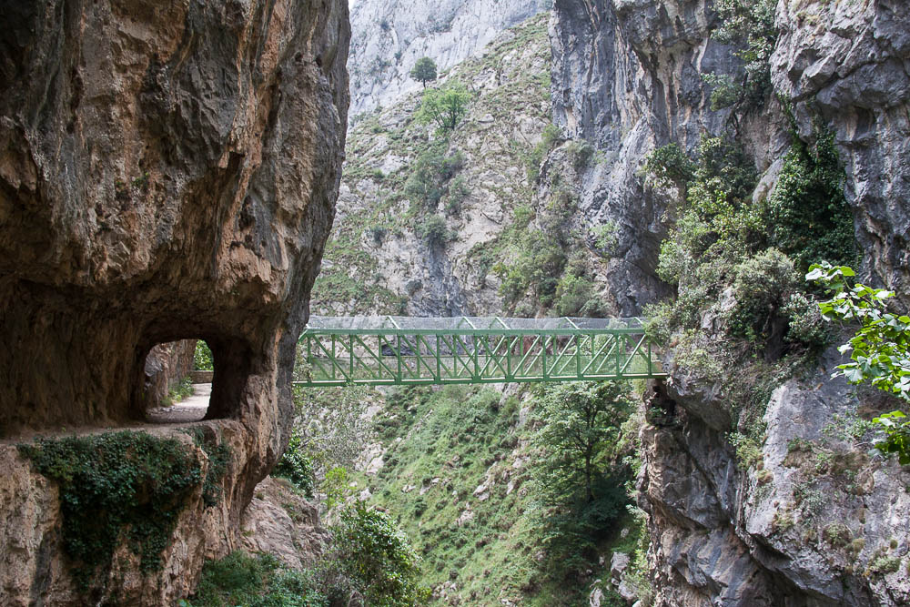
The trail was built after the Spanish Civil War to connect the regions of Cabrales and Valdeón. It is one of the most famous paths in the Picos de Europa, crossing caves, two bridges, paths carved into the rock, 70 drilled tunnels, waterfalls, and footbridges.
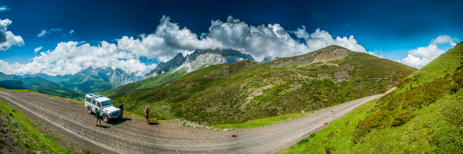
Subida Poncebos
-
2. Where to start the Cares Route without a car?
-
From Poncebos (Asturias): Ideal if you are staying near Cangas de Onís or Arenas de Cabrales. Note that starting in Poncebos involves a 2 km climb at the beginning. As the route is linear, you can use transport services or 4×4 tours to avoid the return walk.
-
From Caín (León): This start is flatter. If you are staying in the Cangas de Onís area, you can take a 4×4 tour from Cangas de Onís to Caín and then hike the trail.
Note: Starting from Caín means beginning with a descent. Most of the path is flat until you reach “Los Collaos,” 2 km before Poncebos, where you begin the descent into Poncebos.
-
Llegada a Caín
3. How to do the Cares Route without a car?
-
4×4 Tours in Picos de Europa: You can book a service that picks you up in Poncebos or Caín, helping you avoid the 24 km round-trip walk. This option includes an interpretive guide and access to restricted areas.
-
Public Transport and Taxis: You can reach nearby towns by bus and hire a taxi to travel between Poncebos and Arenas de Cabrales, avoiding parking issues.
-
Parking in Cangas de Onís: If you are traveling by camper van, the El Llerau area in Cangas de Onís is a good alternative. From there, you can hire a shuttle/transfer to the route.
Rutas 4×4 Picos de Europa
4. Transportation and Transfers
-
Option 1: Drive to Poncebos and park near the Puente Poncebos or the Bulnes Funicular (parking is free but fills up). Alternatively, park in Arenas de Cabrales and take a taxi to Poncebos (6 km distance) to avoid the limited parking at the trailhead. After the 3–4 hour hike to Caín, you can take a pre-booked 4×4 tour back to Poncebos to retrieve your car. It is recommended to start walking by 9:30 am, as most 4x4s leave Caín around 2:50 pm.

Option 2: Start a 4×4 tour directly from Cangas de Onís. This is ideal if you are staying in the area, as you avoid all personal driving. The tour concludes in Caín around 2:00 pm (lunchtime). After eating, you hike the Cares Route to Poncebos, where a vehicle will pick you up and return you to Cangas de Onís.


NOMBRE:https://www.vivepicos.com/en/4×4-off-road-route-from-cangas-de-onis-and-the-route-of-cares/
DIRECCIÓN:
4×4 OFF-ROAD ROUTE FROM CANGAS DE ONIS AND THE ROUTE OF CARES
5. Tips
-
Know your route: Decide if you are starting in Caín or Poncebos.
-
Supplies: Bring water and food. Do not drink water from the canal or river; it is spring water and lacks chlorine/purification. Never throw stones into the river.
-
Children: The route is suitable for children over 8 years old who are accompanied by an adult, but be aware there are no railings.
-
Safety: It is not recommended for people with vertigo. Be extremely cautious when taking photos near the edges.
-
Gear: Wear mountain boots or trekking shoes, warm clothing, a raincoat, sunscreen, and sunglasses.
-
Connectivity: Carry a fully charged mobile phone. Note that there are stretches without signal. In Caín, only Movistar mobile coverage works reliably.
6. Frequently Asked Questions (FAQ)
-
-
Where to park in Poncebos? In summer, traffic is restricted after 9:00 am. It is recommended to arrive early to park near the Bulnes Funicular.
-
Are there opening hours? No, access is free. However, consider daylight hours for safety.
-
Is it dangerous? It is not dangerous if you follow recommendations. The route is in a natural area, and weather can change quickly.
-
Can you eat on the route? There are restaurants in Caín, or you can bring your own food.
-
Best time to visit? Spring, summer, and autumn. In winter, rain makes the path more difficult.
-
Can you cycle? No, cycling is prohibited.
-
Is it paid? No, the route is free.
-
Puente de los Rebecos
